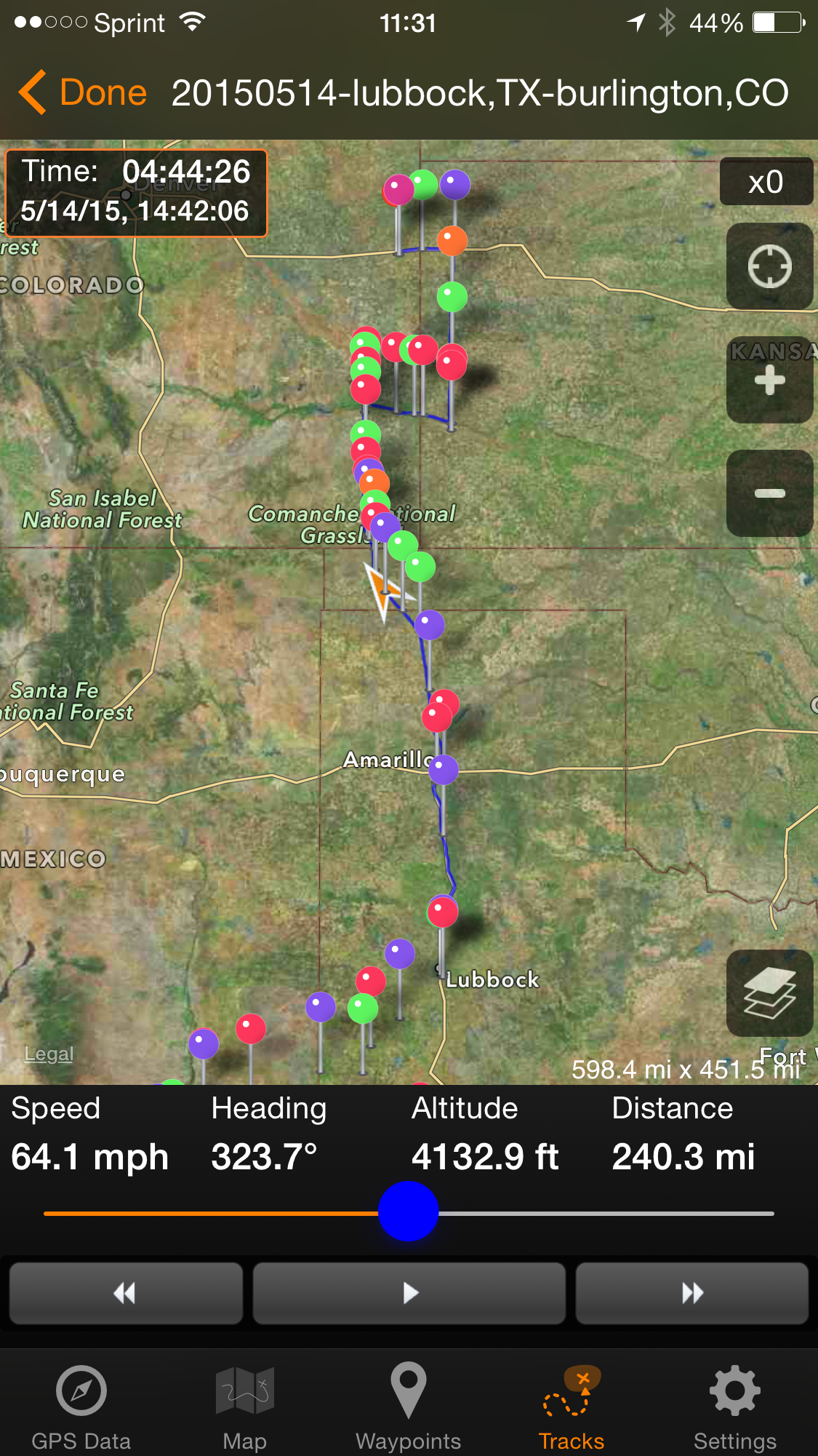
Leg 1: Oklahoma City, OK- Geary, OKLeg 2: Geary, OK to I-35NLeg 3: I-35N (near OK-KS border) to Andover, KSLeg 4: Andover, KS – El Dorado, KS – Emporia, KS
Events of the day
7:00 AM – wake, shower, dress
8:00 AM – Large, hot breakfast: Eggs, yogurt, fruit, bagel, cream cheese
10:50 AM – Matt and I take a photo of ourselves and our chase vehicles.
First two TORNADOes of the trip
11:00 AM – Safety briefing; brief presentation
Bill Reid gives our first weather briefingJoke: Emergency underpants (for when we get too close to a tornado) Useful: a digital caliper for measuring hail
11:45 AM – load the vans. Here’s the Van 1 (lead van) crew for the day!
Van 1, Day 1: Front: (left) Kathy, Phil (both UK) Lisa (me), Sonia (France), Carol (Utah), Dave (UK) Driver: Matt (Tennessee); hiding: Bill Reid (meteorologist, lead)
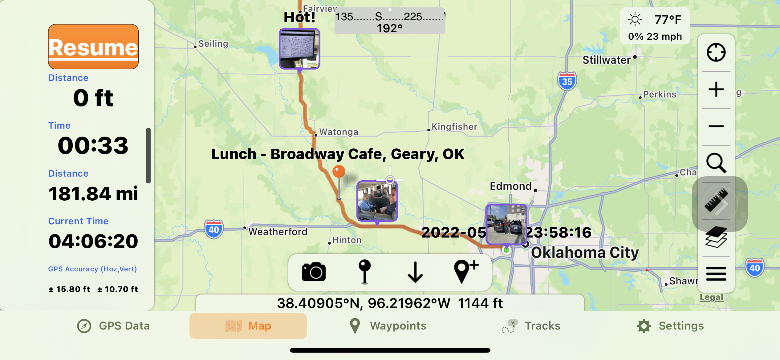
12:00 PM? – headed west to Geary,OK.
2:00PM? – Had lunch (BLT) at the Broadway Cafe.
3:00 PM? – Weighed our options: position ourselves for a play in Texas versus head into the northern plains, where are the next three days all have decent severe potential. Mosied North then entered I 35.
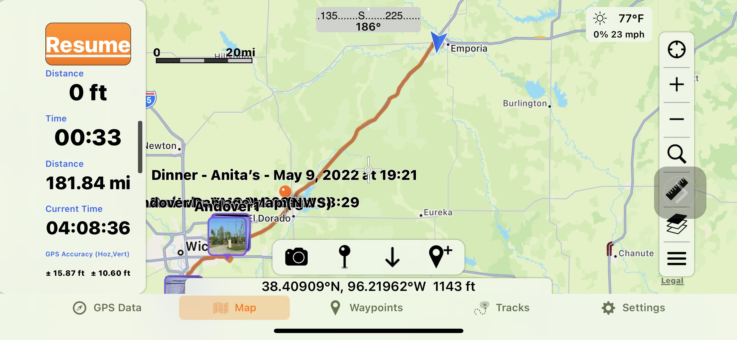
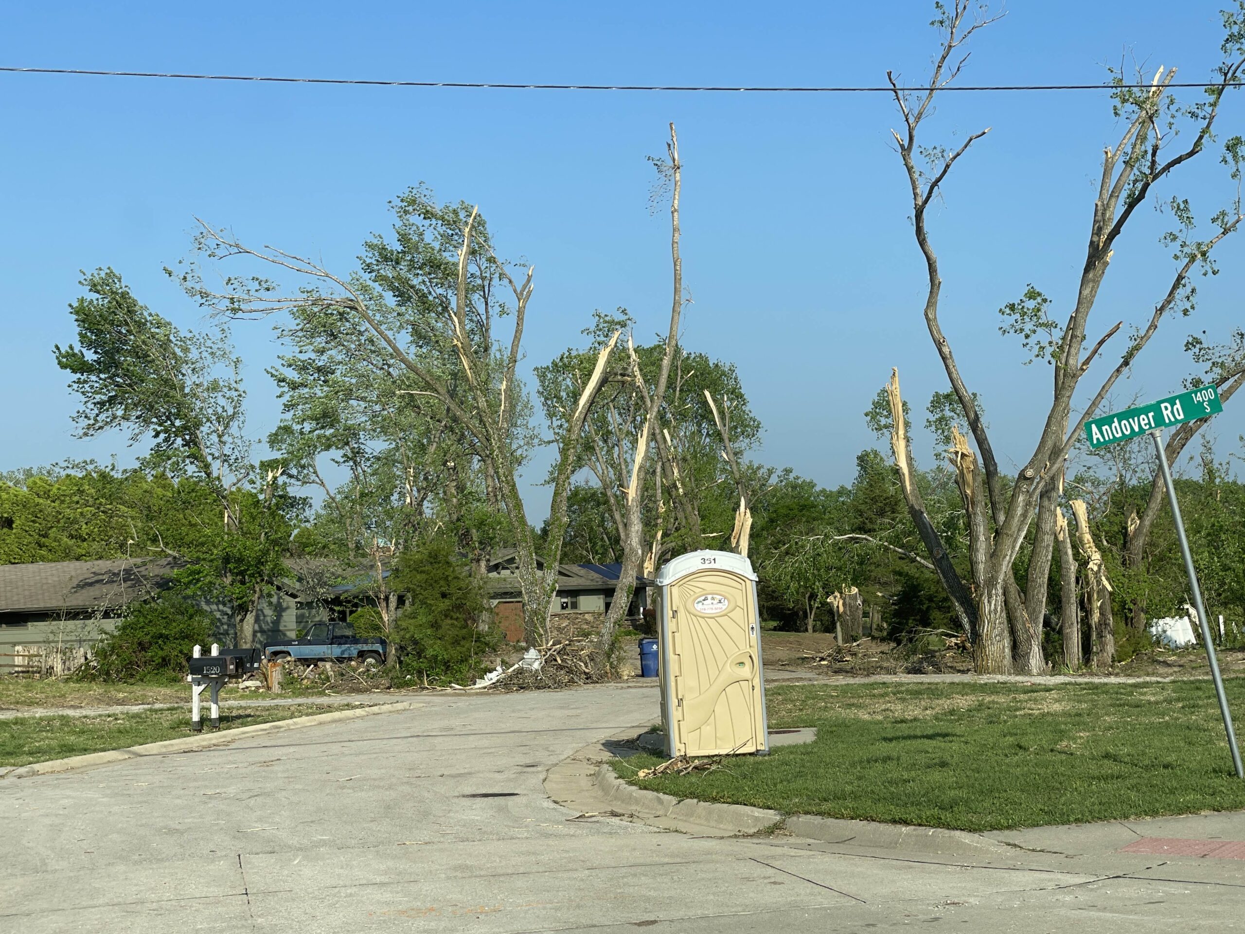
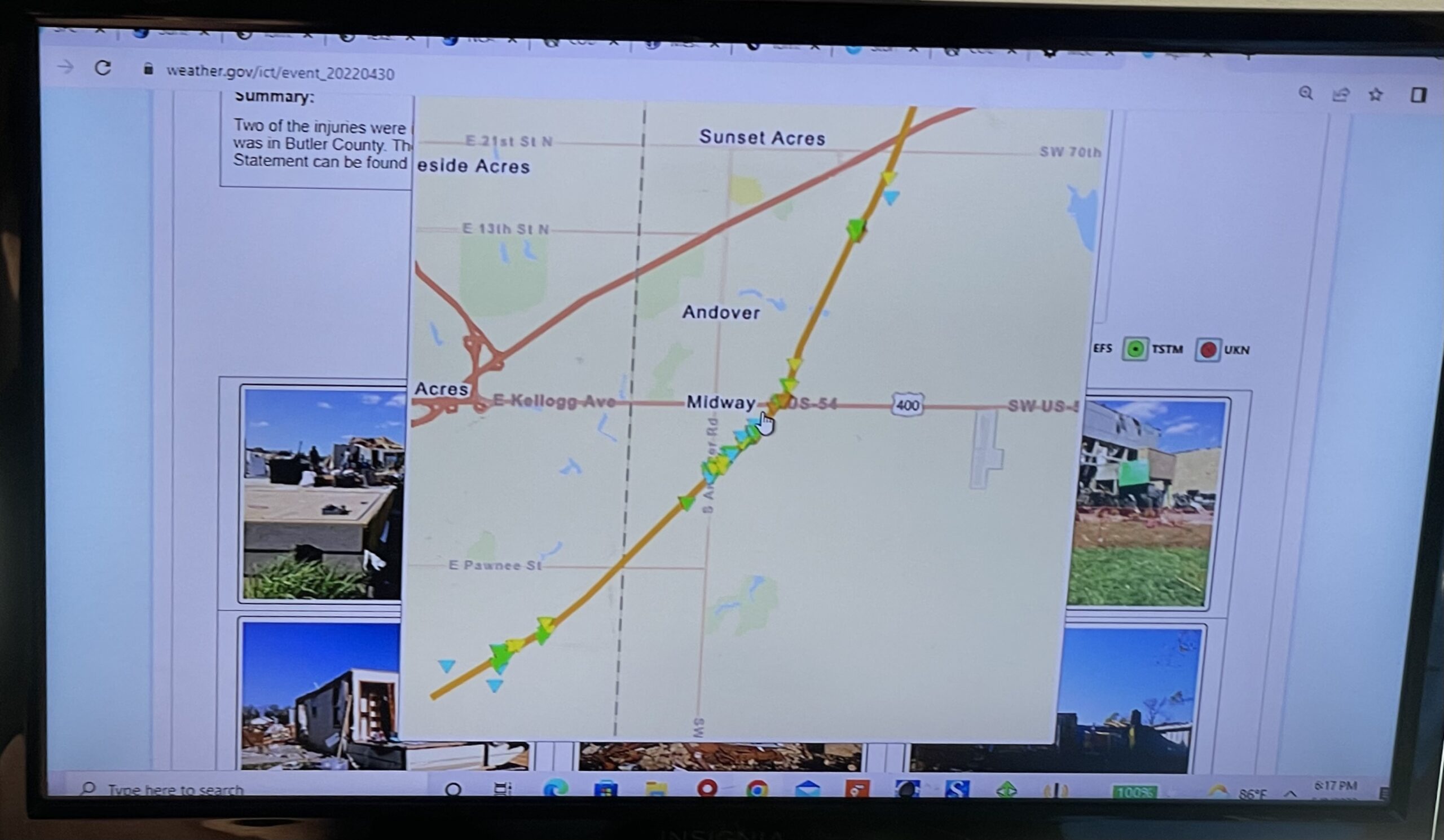
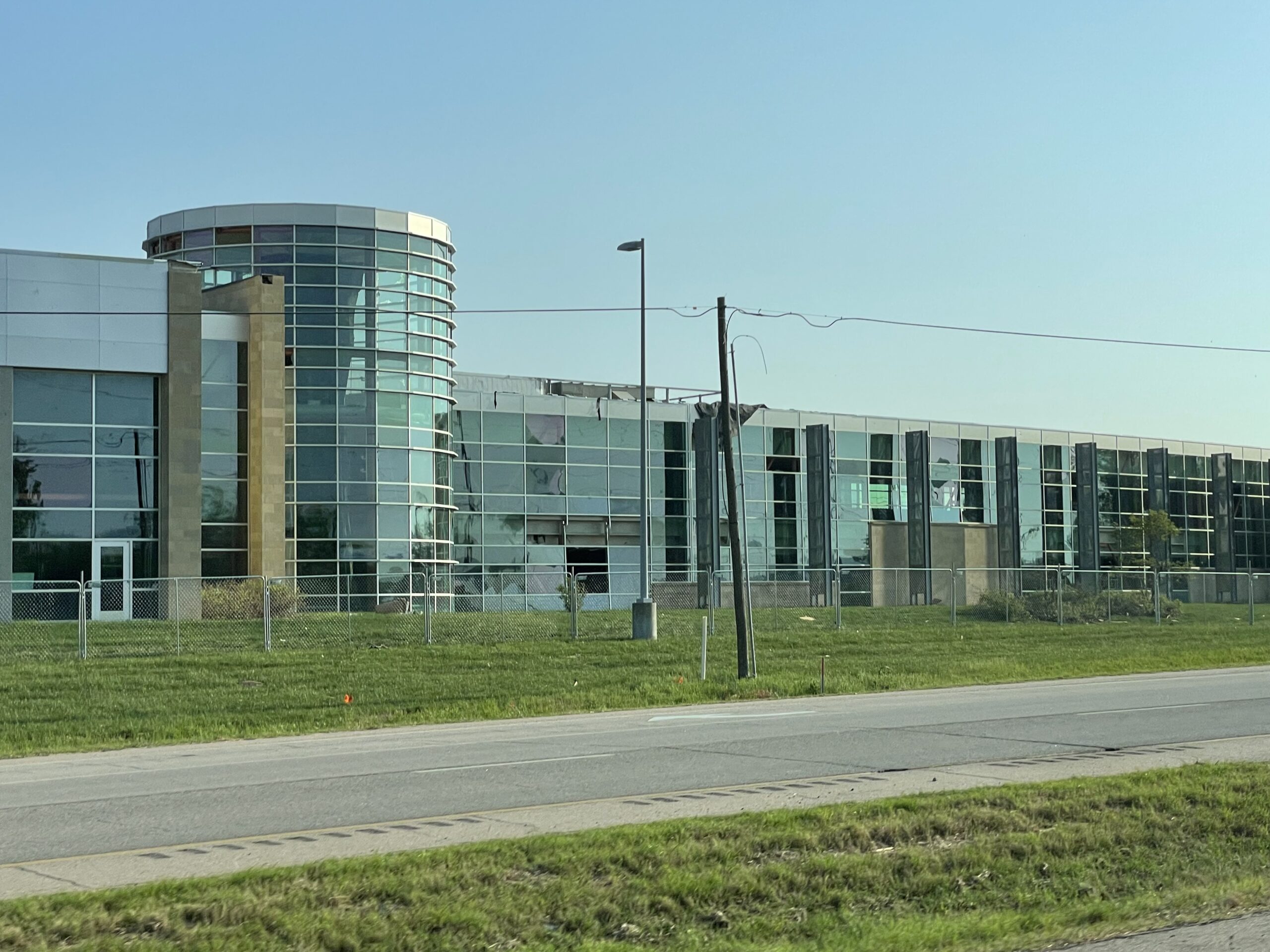
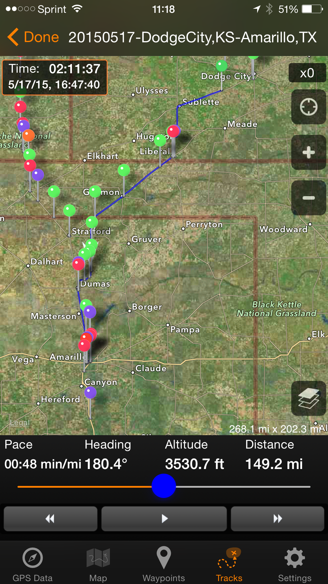
6:00 PM? – Detoured off of I 35 to visit the damage path for the Andover tornado (29 April). The path was quite narrow but had some F2 damage.
Devastated neighborhood along Andover Rd., south of US 400NWS map summarizing the storm damage from the 29 April 2022 Andover, KS tornadoLots of damaged and missing windows at a YMCA building along the Andover damage path.
7:00 PM? – Reentered I 35 and continued north. Exited at El Dorado. Ate dinner at Anita’s (Mexican: shrimp cocktail and Carne Asada; great tasting food, but I ate too much and got an upset tummy).
8:15 PM? – Continued north on 835. Bill called numerous hotels and we finally ended up at the Super 8 in Emporia, Kansas.
1730 – Grab dinner at Golden Palace, an excellent Chinese buffet on the Meridian strip. Unlike Zio’s, the Italian restaurant several blocks south, the Palace had no waiting line (but lots of people dining, just the same). Given that COVID-19 has driven so many restaurants out of business, I’m delight to see that pretty much every restaurant on Meridian (between the airport and I-40) seems to be thriving.
1800 – Do a little computer and battery maintenance. Charge up the AX53 camcorder batteries that arrived the day before I left of this trip. Adding these batteries gives me nearly 8 hours camcorder running time between recharges!
2000 – Watched Guardians of the Galaxy, Volume2 on the room TV. Still a fun flick after a number of viewings. Our generation is very fortunate to enjoy the genius of Stan Lee, creator of the Marvel universe.
2200 – Charge the Fitbit, listen to my bible podcast, and drift off to sleep.
07:00-11:00 – work from home, online, that is. (Don’t lots of folks do that now?)
11:00 – Lunch at Charlie’s (Bolingbrook Clow International Airport).
(They have scheduled flights to Canada, so ‘International” is quite real.)
12:12 – Depart Bolingbrook Airport, traveling southwest on I-55S.
14:09 – A brief pit stop in Atlanta, IL. Still good on fuel!
14:22 – Resume southwesterly course on I-55S
15:25 – Oh no. traffic jam!
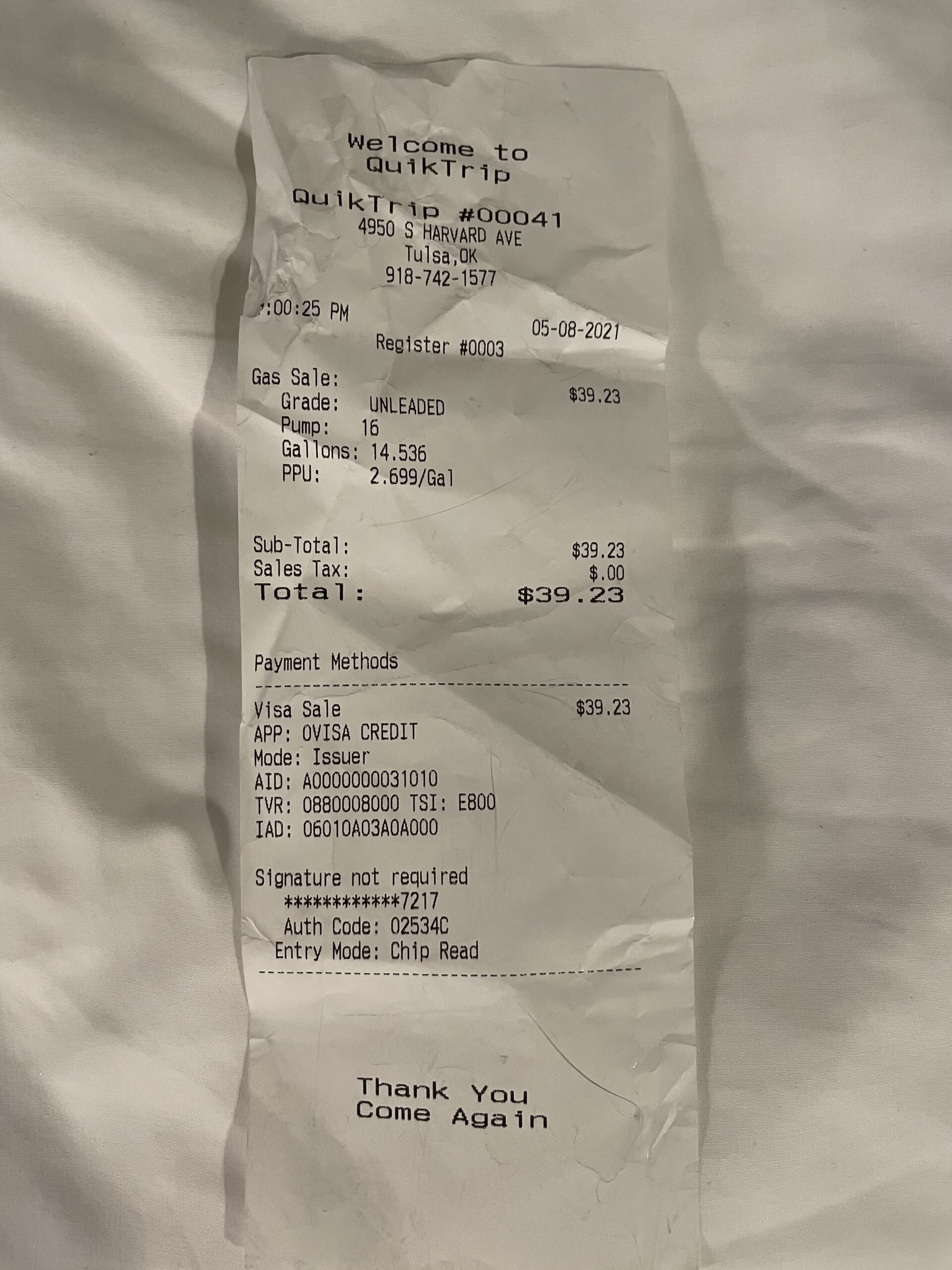
17:28 – Refuel at St. Clair, MO, just west of Six Flags enough to avoid paying a premium price for gasoline.
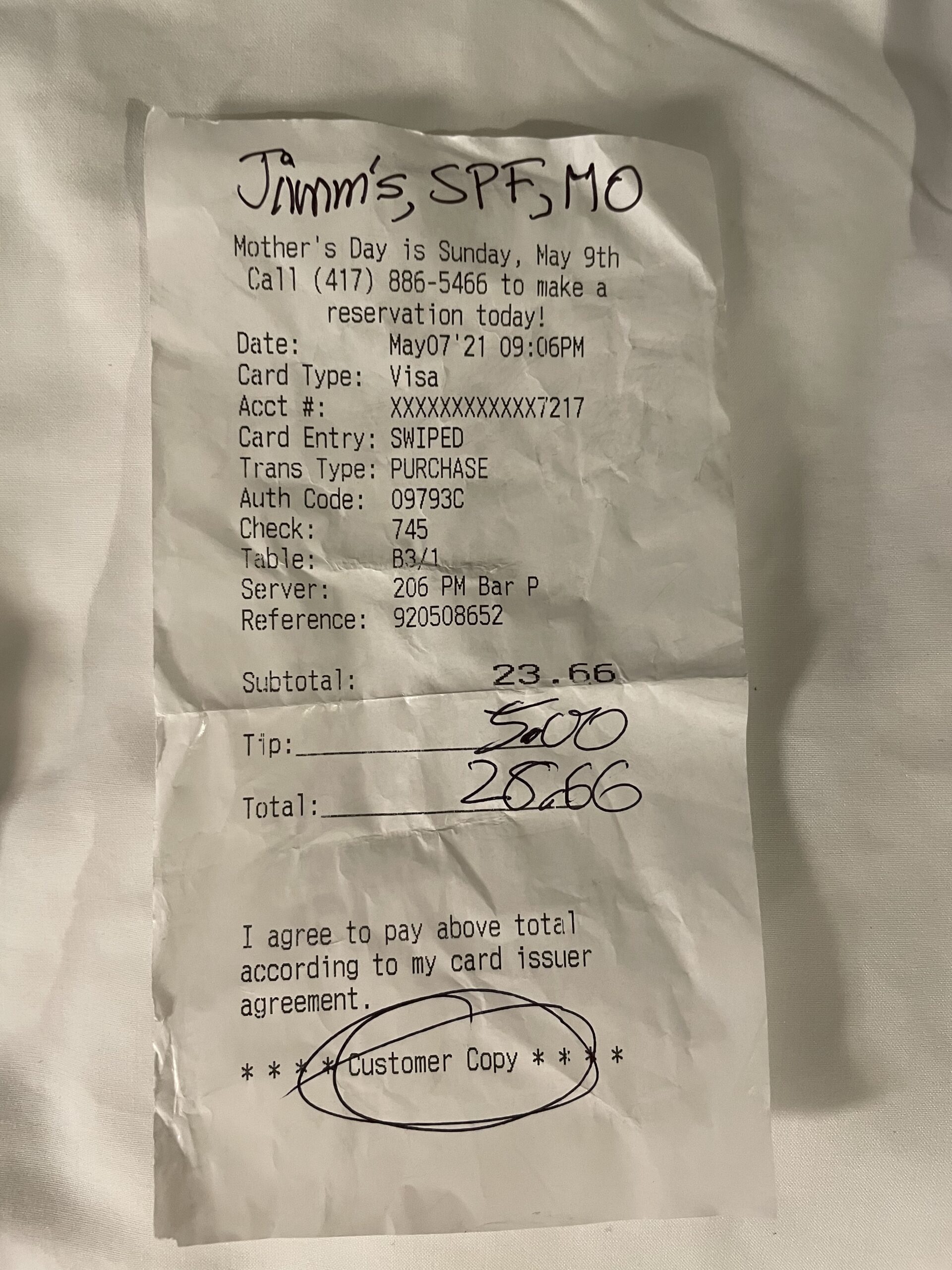
2100 – Arrive at Red Roof Inn, Springfield. Check in then eat dinner at Jimm’s Steakhouse and Pub. Had the monstrously generous prime rib dip (like a classic French dip, but using prime rib). Too much food!
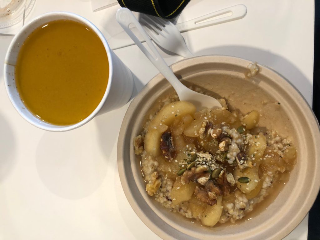
First, drove from the motel in Bolingbrook into the Loop of Chicago. After an unplanned orbit of Lower Wacker Drive, we got into our parking garage and walked to breakfest. I had a tasty apple-walnut oatmeal and my first-ever (and probably last-ever) keto coffee.
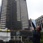
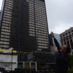
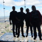
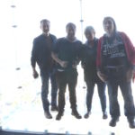
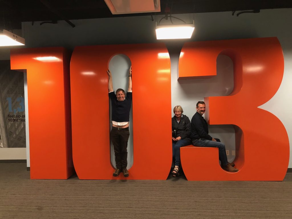
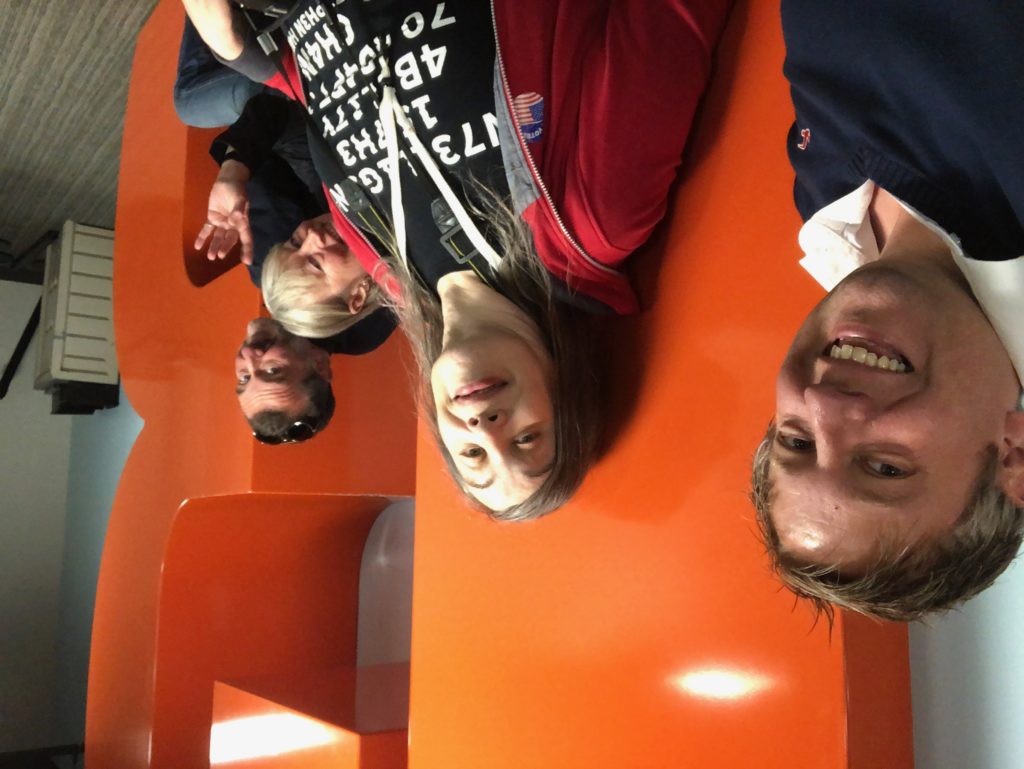
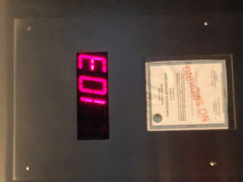
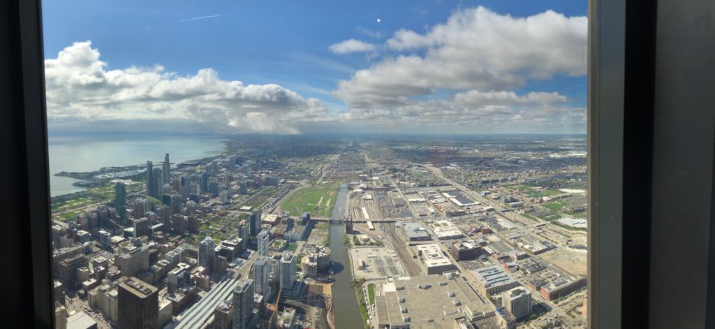
Then, we walked across the street and went up to the 103rd story attractions of the [former] Sears Tower (a/k/a the Willis Tower).
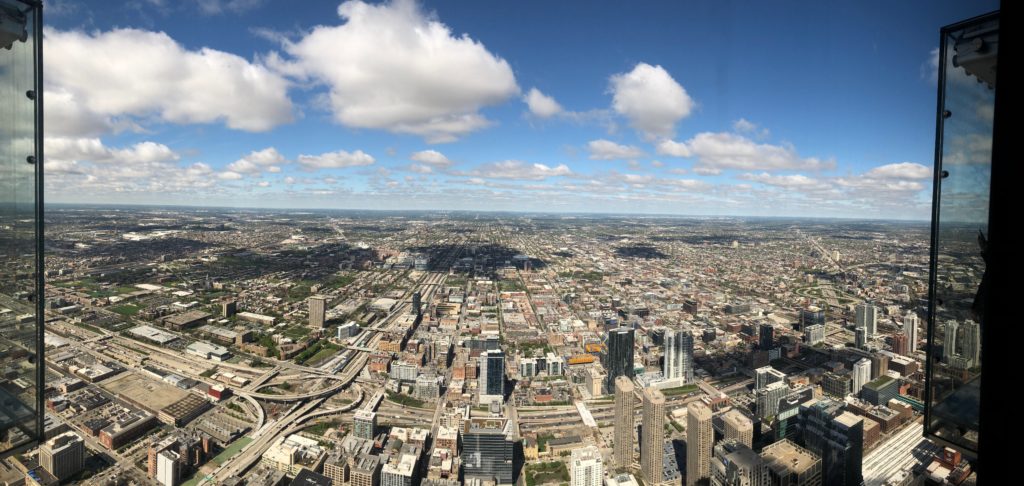
The views were spectacular, but when I stepped out onto The Ledge, I got dizzy and withdrew immediately. My #FearOfHeights kicked in hard. After a moment of calming down, I backed into my slot in the transparent box so high above the street and we were able to get a few pictures.
Morning fountain, 311 S. Wacker
Looking up 1
Looking up 2
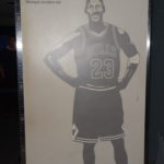
How many Jordans tall?
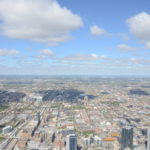
THe west from the SKydeck
Really bright!
Another view from the 103rd
Looking out in each of the four compass point directions, we took in the amazing views. The multiple shades of view on Lake Michigan, looking to the north, was astonishingly beautiful!
Along the Way: Fill-Up Philip
After of hour of “103” time was up, we returned to the car, headed west on Madison Street, and took I-94 and I-55 southwest, departing Chicago.
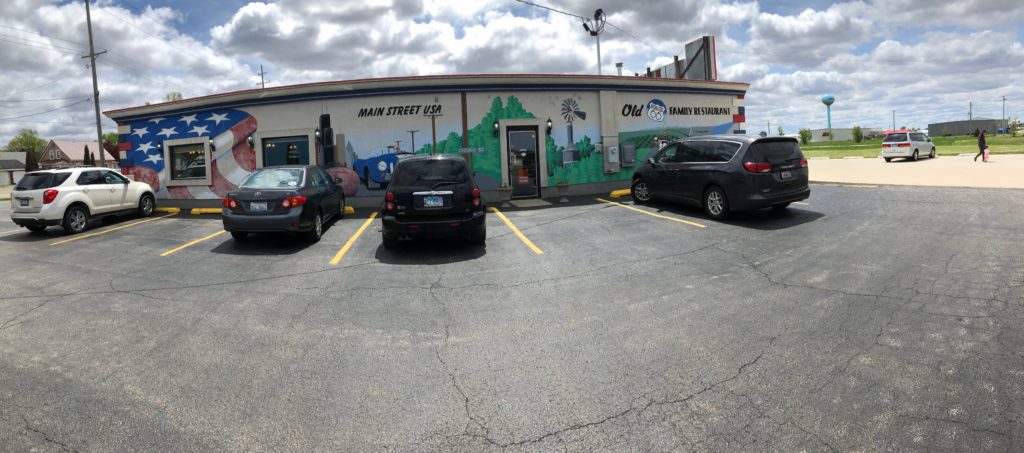
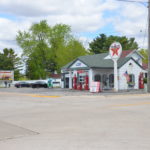
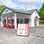
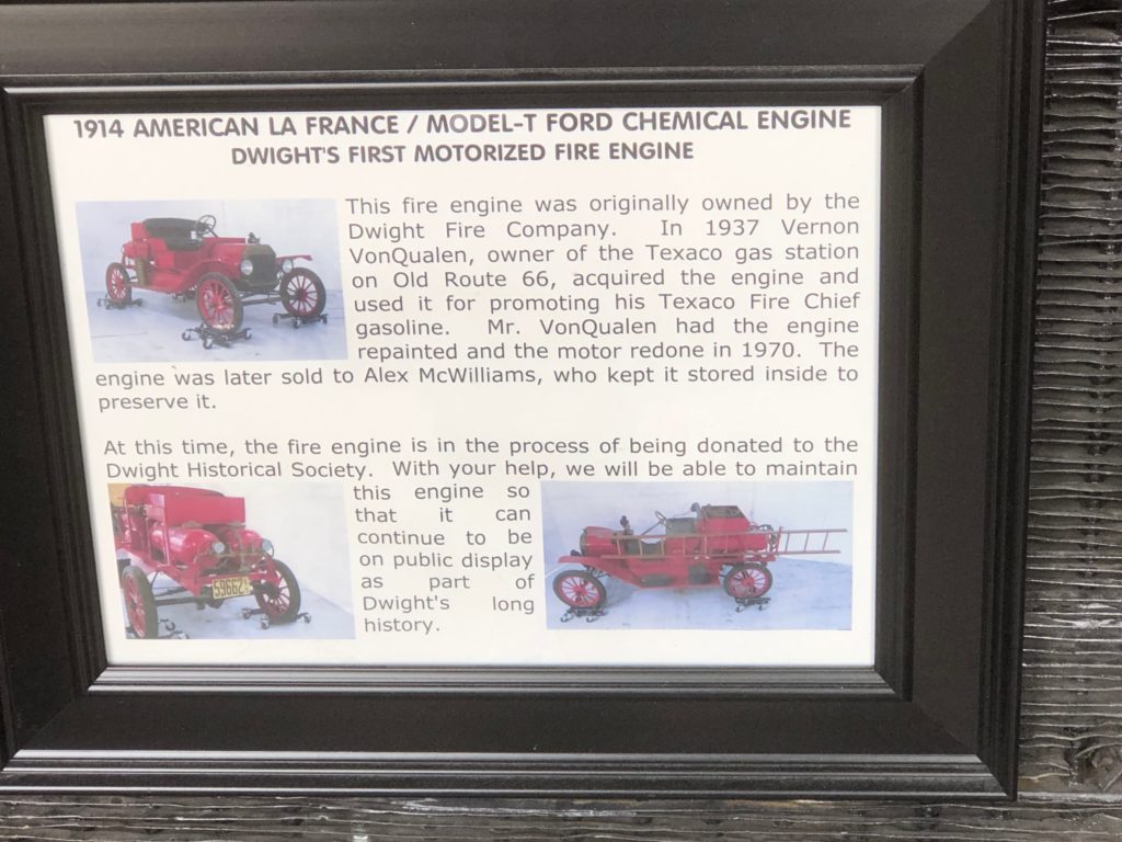
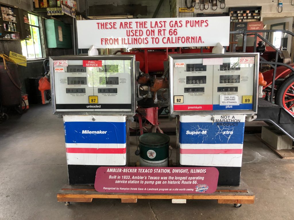
A few hours later, we stopped at Dwight, Illinois for lunch. We had a classic American cuisine lunch (burgers, BLT sandwiches, hot soup), then visited the 1950s-vintage gas station across the street.
The old gas station, Dwight, Illinois
The Dwight US 66 Museum
Tanks a lot
Fill-up Philip
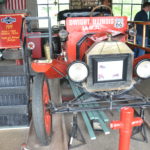
Cool, old fire engine
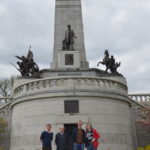
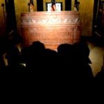
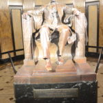
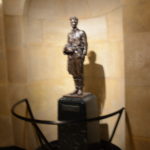
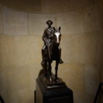
One Tall Tomb
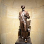
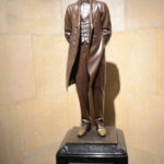
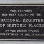
Next stop was the Lincoln Tomb (the actual final resting place of Abraham Lincoln, his wife Mary Todd Lincoln, and three of his four sons. The route to the monument took us through some pretty unassuming side streets (and I was beginning to the the GPS had misguided us). The tomb is topped off with an imposing obelisk and has many beautiful statues of Lincoln, depicting the various stages of is life from young adult to the final year of his presidency.
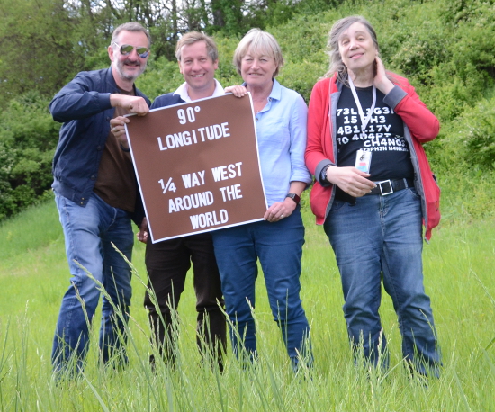
Quarter of the Way ‘Round the World
Continuing southwestward, I pulled the van to the shoulder for our ‘mystery stop’. I must have given half a dozen hints where we were going, what it was about, etc. We got WAY past twenty questions, but my guests finally figured it out without me telling them outright. Here we are after arriving.
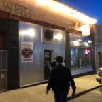
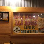
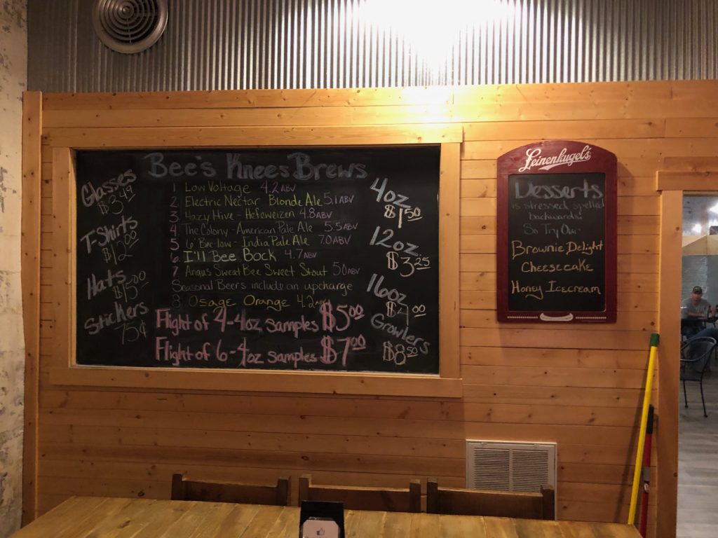
Bee’s Knees
After many more hours of driving, we arrived at our dinner destination in Versailles — pronounced ‘ver-Sails’ — in Missouri. Thanks to a cable between the van’s CarPlay port and my iPhone acting up, I had to rely on my guests’ phones for navigation. (Excellent job adapting to the situation, gang! I am in your debt.) Fortunately, we never got off the desired route, arriving at around 9pm. We met Kathy’s stepdaughter, Allison, at a local microbrewery and restaurant call The Bee’s Knees. Other than a brief whiff of the beer, I abstained (as I was driving). On the other hand, I enjoyed a generous portion of the delicious varieties of thin crust pizza. It was a good thing we were driving; I could barely walk after the meal.
One Last Push
In a final push to our goal of Springfield, Missouri, I drove us on MO 5 toward Lebanon, Missouri and I-44. The winding road, hilly terrain, and stretches of re-paving activy along the way made for a challenging drive, but we arrived safe and sound at Springfield around midnight. Four sleepy travelers went to sleep about 30 minutes later for some very solid and well-earned rest.
11:45 AM – Depart from I-355, entering I-55 southbound. Drove through a brief call shower.
12:28 PM – Passed by Dwight, Illinois. Just saw a northbound Amtrak train heading to Chicago. Feels very like in my childhood memory of travel between Rockford and Monmouth, Illinois. The family used to travel US 34. We used to see many trains along that route. (Sorry, no picture, as I am in traffic.)
Traffic has slowed to a crawl. Seems there is some roadwork or a police action of a head up ahead.
“Work zone speed limit 55 mph.” (Actual speed 24, but it has been 10 mph for the last 10 minutes. Do the math!) And there they are: those people who see the merge signs for the last 2 miles and wait to the last minute to join traffic because they think that the rest of us are stupid and will let them in. And it only takes one generous person to make them right. Now four lanes have become two lanes, one northbound one southbound. The southbound lanes of I-55 or being revealed re-built. (76.3 miles into the trip)
12:49 PM – Left the construction zone at exit 201, Continuing south on I 55. Detour signs indicating the delay was about 13 minutes with results. That feels about right. (Around Pontiac, Illinois)
1:03 PM – South of Pontiac, Illinois. It is wonderfully flat and open near here. This is prime central Illinois chase country. You can see all the way to the Verizon in almost every direction. And the landscape is almost completely free of distractions, except for the occasional microwave, cellular, or radio tower. There are power lines in the distance. A few scattered trees, I’m really not much here. Basically a blank canvas on which to paint a memory. (Tried to take a picture here, it was cut in half the long horizontal. What’s up with that?) I have moved far enough south that I have left the 60°F weather in Chicago and I’m surrounded by 80°F temperatures.
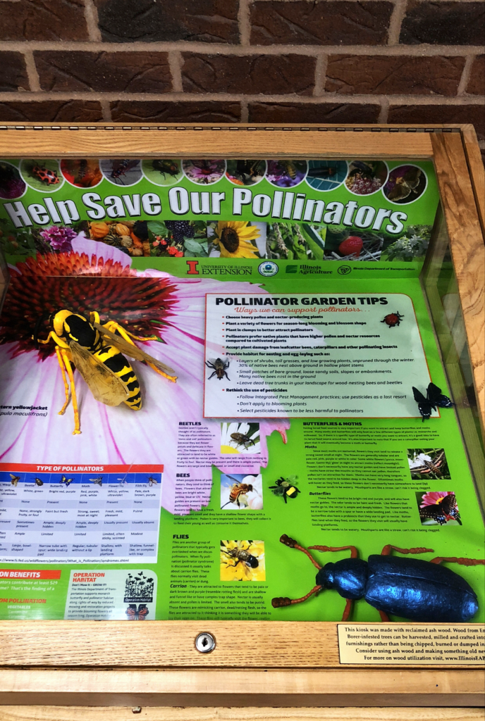
1:36PM – stopped at rest area south of Bloomington-Normal, to stretch my legs, visit the restroom, and grab a light snack. Leving the Illinois pollination exhibit behind, By-bye busy little bee!
1:48 PM – Departed rest stop. Continuing south to St. Louis
2:02 PM – Passing the NWS weather radar at Lincoln Illinois (KILX). It is approximately the midpoint between Chicago and St. Louis along interstate 55.
2:24 PM – travel note: 555 mile post 104 is the location of a rest area on the southbound traffic. This is a little closer to the midpoint of the Chicago St. Louis leg of the journey.
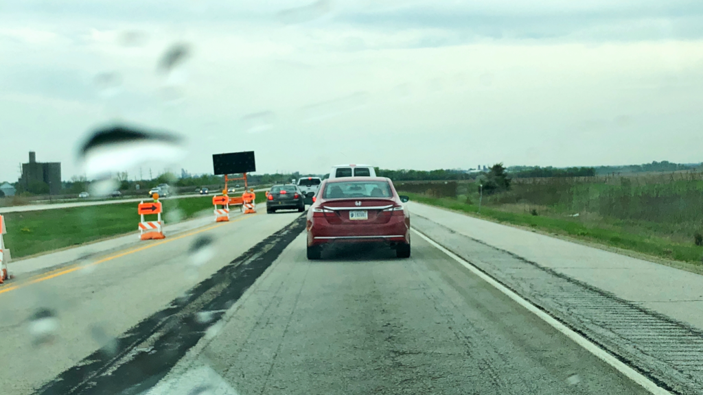
3:24 PM – Just outside St. Louis. Traffic has crawled to a near halt due to construction. We are
grinding along and about 20 miles an hour. Looks like the right lane is closed ahead. We are just south of Worden.
3:37 PM – Exited the construction zone. Very lucky to only have two delays in Illinois. On certain past trips I had 50 miles of construction; this time wasn’t so bad.
4:10 PM – Welcome to Missouri. Took I-255 across to I_44 and beyond. Definitely better than going downtown during rush hour. Temperature here is 91°F. It is like summer! I am loving every minute of it.
5:40 PM- fuel/bathroom/food stop at Roll, Missouri.
8:08 PM – Arrived at Motel 6 North, Springfield, Missouri. Feeling tired but very happy. So THIS is what vacation feels like, I had almost forgotten! Unpacked the van then went to sleep (gently). Zzzzzzz.
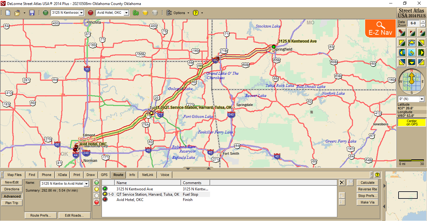
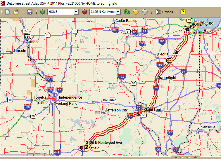
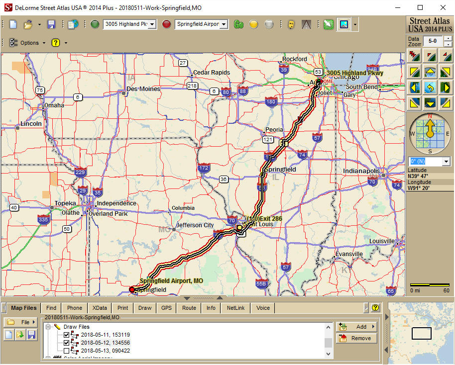
TODAY’S ROUTE: 499.3 miles as shown below (map courtesy of DeLorme Street Atlas 2014):
1019 – Raton Pass (7840ft) – Sangre de Cristo Mountains to Our west
1024 – enter Colorado On I-25W
1032 – Trinidad, CO – the TRINIDAD sign tops a peak just west of the interstate
Xxxx- Walsenburg,CO –
1203 – cont N on I-25 through Pueblo,CO
1232 – Approaching Colorado Springs,CO from the south on I-25N
1409 – Lunch – Qdoba (I-25) – Castle Rock,CO
1418 – WalMart run (10min)
1426 – Dpt E from Castle Rock,CO on CO86 Twd Kiowa,CO
Xxxx – Stop at c-store in Kiowa
Xxxx – stop in the middle of nowhere; take 360 photo.
http://360.io/qRVs8a
Xxxx – enter I-70E toward Limon,CO
Xxxx – Arrive at Econolodge, Limon, CO
xxxx – Dinner at Oscar’s. Delicious pot roast and steamed veggies. A low-carb delight!
Xxxx – Do laundry at the TA Limon, across US24.No quarters required: machines take credit cards AND add no surcharge Woohoo!


 One Tall Tomb
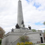

 One Last Push
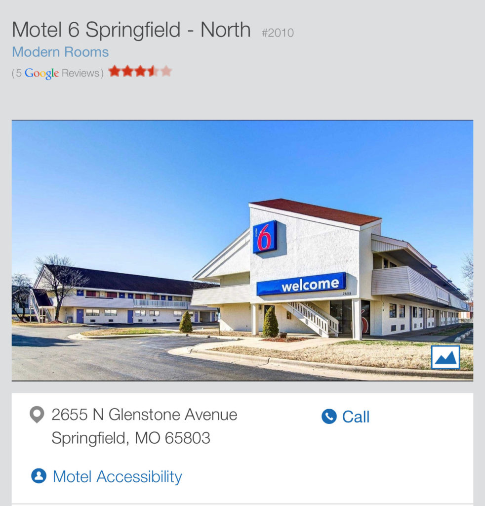


